カテゴリー: 航空と宇宙

天の川銀河ブラックホールの爆発放射が宇宙空間を照らす

フェミル・バブル

およそ350万年前に、我が「天の川銀河」の中心にある超巨大なブラックホールが爆発して膨大なエネルギーを放出した。その頃アフリカに出現していた人類の祖先は、夜空を明るく照らす光を射手(いて)座 (Sagittarius)の方向に見たに違いない。この光はその後100万年の間続いたと思われる。(About 3.5 million years ago, the massive black hole at the center of our Milky Way galaxy flashed an enormous burst of energy. Our Primitive ancestors, already afoot on the African land, likely would have witnesses this flare overhead in the constellation Sagittarius. It might have consisted for one million years.)

クルードラゴン、NASA宇宙飛行士を乗せISSに到着

49953052258_b9a7d6971d_k_0

スペースX・クルードラゴン宇宙機が、NASA宇宙飛行士2名、ロバート・ベーンケン、ダグラス・ハーレイ両氏が搭乗して、フロリダ州ケネデイ宇宙センター39A号発射台から5月30日午後3時22分(東部夏時間/ETD)にファルコン9 ロケットで打上げられ国際宇宙ステーションに向かった。(For the first time in history, NASA astronauts have launched form American soil in a commercially build and operated American crew spacecraft on its way to the International Space Station. The SpaceX Crew Dragon carrying Robert Behnken and Douglas Hurley lifted off at 3:22 p.m. EDT Saturday on the Falcon 9 rocket form Launch Complex 39A at Kennedy Space Center.)

令和2年5月、我が国周辺における中露両軍の活動 および 米国CSBAの報告 “日本に挑戦する巨竜”

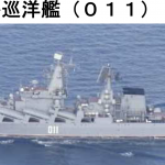
05-17 ウダロイ548

令和2年5月、我が国周辺における中露両軍の活動として統合幕僚監部が発表した中露両軍の活動は1件のみ、しかし、中国海警局艦艇による沖縄県尖閣諸島周辺の領海、接続水域への侵犯は4月中旬から1日も休むことなく5月末日まで48日間連続した。この中には、5月8日、9日に発生した魚釣島領海で操業中の我国漁船への追尾事件も含まれる。殆どの我国マスコミは報道しなかったが、注目すべき報告書が米国で5月19日に発表された。米国の有力研究機関CSBAが、日中海軍力を比較した「日本に挑戦する巨竜:日本の海洋パワーに対する中国の見解」と題する報告書である。(According to the Japan’s MOD Joint Stuff, Russian and Chinese Forces movement around the Japanese Islands was one. The Chinese Coast Guard Ships, however, has being penetrates Japan’s territorial waters around Senkaku Islands, since mid-April to the end of May for 48 consecutive days. On May 19, a major US sink-tank CSBA issued a report titled “Dragon against the Sun”, describing “Chinese views of Japanese Seapower”.)

LiDARの開発と応用(第4回) -自動車への応用(その1) –

図1

2020年1月22日の第1回および4月22日の第2回で紹介した様に、LiDARは、Light Detection and Ranging (光検出と測距)もしくはLaser Imaging Detection and Ranging (レーザー画像検出と測距)の略で、光を用いたリモートセンシング技術の一つである。今回および次回は、自動車関連分野に関する応用、特に自動運転のセンサーとしてのLiDARを中心に紹介する。(今回は自動車企業での状況を報告し、次回はLiDAR開発企業の状況を紹介) 自動運転においては各種のセンサー技術が開発され、一部は実用化されつつある。その一つとしてLiDARは重要な位置を占めるものであり、世界の多くの研究所、企業(大手自動車企業からスタートアップまで)において研究開発が進められている。
(As explained in the reports dated January 22 and April 11, LiDAR, the acronym of Light Detection and Ranging or Laser Imaging Detection and Ranging, is one of remote-sensing technologies applying optics. In this report as well as the following one, applications of LiDAR for automobile, especially for autonomous driving, are introduced focusing on car manufactures in this report, and LiDAR vendors in the following report. As for the autonomous driving, various types of sensor technologies have been developed and some of them have been already applied to commercial vehicles. Among such sensor technologies, Lidar is positioned as the important one, which is under development in many laboratories, enterprises from big names to start-ups.)

スペースX ・スターシップ、高度150mの跳躍飛行へ

月面着陸

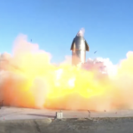
NASAは4月30日、月面有人着陸計画「アルテミス(Artemis Program)」に向け、スペースXが開発中の「スターシップ(Starship)」を月―地球間の輸送機として選定した。契約は、設計・製作費として1億3,500万ドル、を支給、スペースXは2020年代中期に宇宙飛行士数名を乗せて月に輸送する。「スターシップ」は、月や月周回軌道上の宇宙基地と地球を往復する輸送機で、機内は広く多数の人員や貨物を輸送でき、月面基地の維持に重要な役目をする。(NASA selected SpaceX to develop a Lunar optimized Starship to transport crew and cargo between lunar orbit and Moon surface for NASA’s Artemis program. The Starship can fly many times between Moon/lunar orbit space station and Earth without flaps or heatshield. With large habitable and storage volume, Starship can deliver large amount of cargo and people on the lunar station.)

テキストロン・セスナ 408 スカイクーリエが初飛行

0518_Cessna_SkyCourier_flight

テキストロン・エビエーションのセスナ(Cessna) 408 スカイ・クーリエが5月17日にウイチタ(Wichita, Kansas)東部にあるビーチ・フィールド空港で初飛行した。セスナ408は双発の多用途機で、2時間15分の飛行だった。これから初号機を含む5機で型式証明取得の作業が始まる。(Textron Aviation Inc. announced today the successful first flight of new twin utility turboprop, the Cessna SkyCourier, where it flew for 2 hr 15 min. and kicked off the flight test program.)

JAXA、国際宇宙ステーションへ “こうのとり” HTV-9を打ち上げ

スクリーンショット 2020-05-18 15.56.05

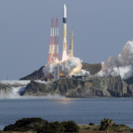
JAXAは、種子島宇宙センターからH-IIロケット9号機で、5月21日(木)午前2時30分に国際宇宙ステーション・ISSに向け、貨物輸送無人機 ”こうのとり” 9号機「HTV-9 」を打ち上げる。”こうのとり“は最大約 6 tonの貨物を搭載でき、一度に複数の大型実験装置を運搬できる。(A Japanese cargo spacecraft loaded with experiment hardware, supplies and spare parts is scheduled to launch from the Tanegashima Space Center at May 21, 2020 local time. JAXA unmanned HTV-9 carries investigations testing a new livestreaming educational tool, microscope and telescope. The HTV able to carries six ton cargo to the ISS.)

防衛装備庁、レーダー/赤外線複合センサー技術で探知距離を拡大

UP-3Cのコピー

防衛省・防衛装備庁は、開発中の複合センサー・システムを使うことで、来襲するステルス戦闘機、弾道ミサイル、巡航ミサイルなどの探知可能な距離を20 %拡大できる、と明らかにした。(The Defense Ministry of Japan has reported a 20 % improvement in detection range with a newly developed fused sensor system for use against stealth aircraft, ballistic missile and cruise missiles.)

初飛行から30年、ベル・ボーイング V-22 オスプレイの近況

マリーン

ベル・ボーイングが共同開発したV-22オスプレイ(Osprey)は、1989年3月19日の初飛行から30年経過したが、今でも世界で唯一の実用化に成功したテイルトローター機である。米海兵隊が制式化したのが最初、続いて空軍が採用し予定数の受領を完了、海軍が受領を開始したのは2020年、我が陸上自衛隊は2020年5月に初号機を受け取った。V-22はこれから一層の性能向上を目指して改修の段階に入る。

(The first, and only, operational military tiltrotor, the Bell-Boeing V-22 Osprey first flew more than 30 years ago, in March 19, 1989, in service with U.S. Marine Corps and U.S. Air Force, and to be deployed by U.S. Navy and Japanese Army. The V-22 is now entering a new phase of life with a series of significant upgrades.)

LiDARの開発と応用(第3回) – 航空機への応用

LiDAR 航空機応用 図1

2020年1月22日の第1回および4月11日の第2回で紹介したが、LiDARは、Light Detection and Ranging (光検出と測距)もしくはLaser Imaging Detection and Ranging (レーザー画像検出と測距)の略で、光を用いたリモートセンシング技術の一つである。今回は、航空への応用、特に空港付近での風の計測のためのLiDARを中心に紹介する。ウインドシアと呼ばれる大気の現象を滑走路の近くに設置したLiDARあるいは航空機搭載のLiDARで検知することは、離発着時の墜落事故の防止策として重要である。(As explained in the reports dated January 22 and April 11, LiDAR, the acronym of Light Detection and Ranging or Laser Imaging Detection and Ranging, is one of remote-sensing technologies applying optics. In this report, the applications of LiDAR for aviation fields are introduced, especially, to measure the wind near airports. It is quite important to detect wind shear, dangerous atmospheric phenomenon, to avoid clash of aircrafts in their takeoffs and landings by the LiDAR equipment installed near runways as well as on aircrafts.)